
On Friday we launched Mapfest – after spending a days and nights since the beginning og September wrangling data and building software. The project started with the Norwegian Mapping Authority giving us a head start with a large packet of geospatial data they were going to freely license.
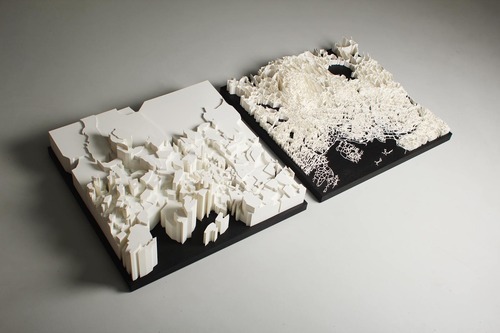
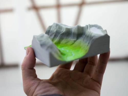
To give everyone a flying start with the data we’re packaging it up as ready-to-run VM. We also built a service where anyone can get a custom printed slice of Norway from Shapeways – right from the browser – and laser sintered a two sculptures from the data.
We had great fun with this project and would have posted pictures from the release party on Friday if we hadn’t been too tired and euphoric to remember to actually take any.
More from the blog
- Bengler Wins Jacob’s Prize 2016
- Simen made an opera about transhumanism*
- Deep Learning at the Museum
- Status / Arrivals
- Lego vs. Lego
- Spare Time Protein Origami
- GRBL with permissive license (MIT)
- We're building a 3d printer!
- Terrafab, now available in huge and tiny
- Checkpoint: Repcol
- Launch: Mapfest!
- Being in Nothingness
- Planning the brewery