Genre
Open data mediation marathon
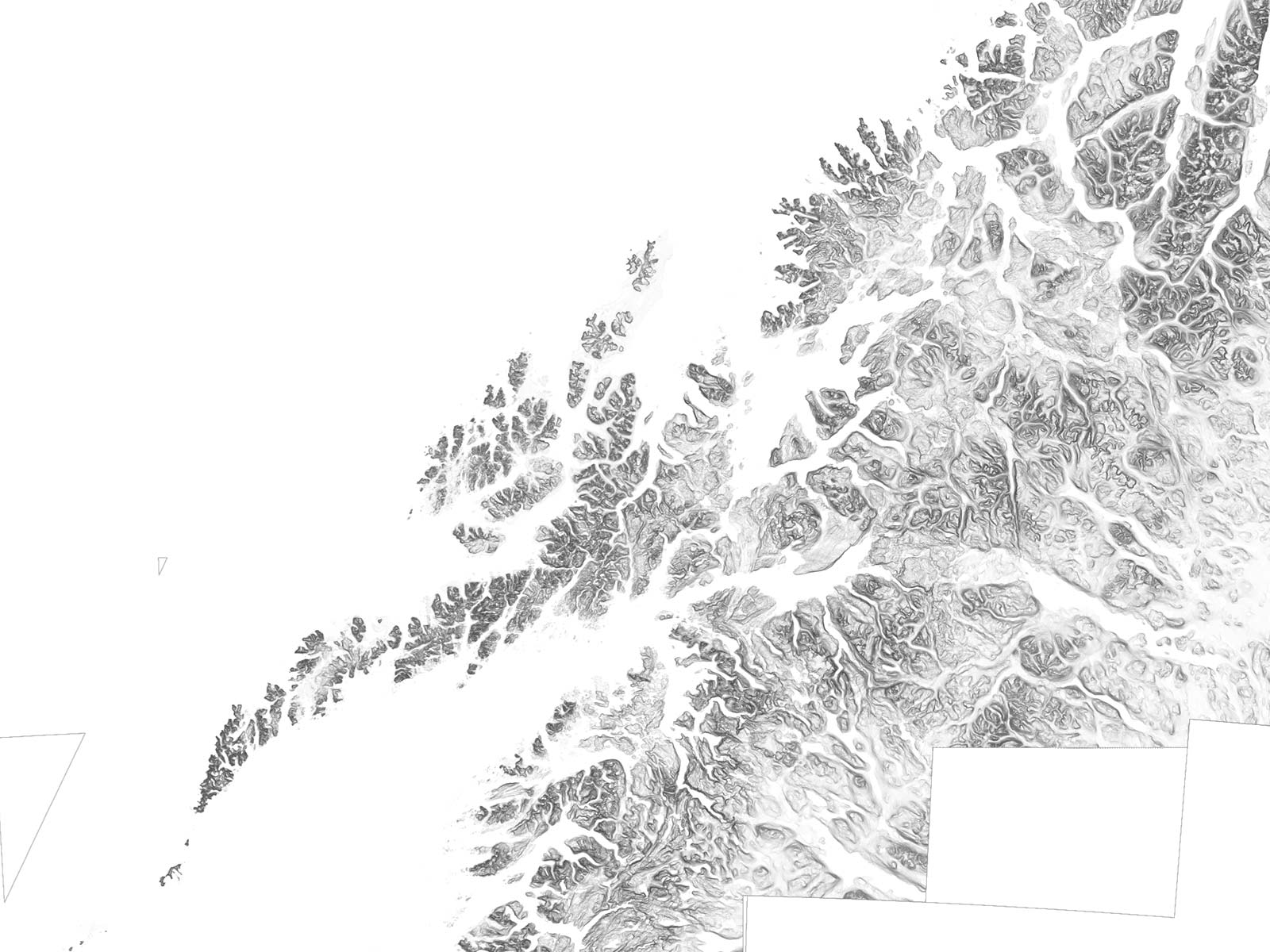
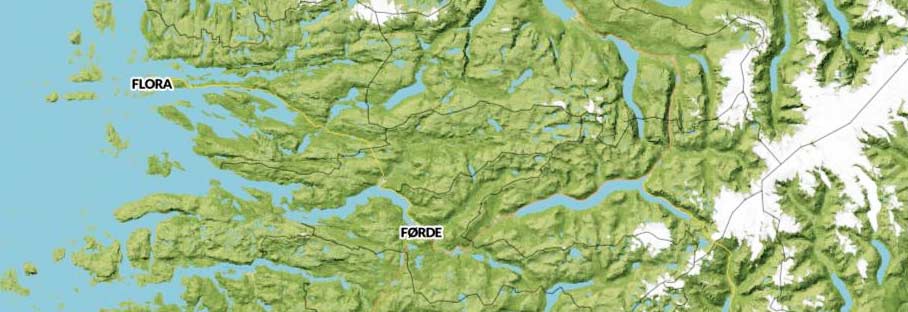
Data sets
N50, 10m x 10m Elevation Maps, Placenames
Client
Released
2013
As a going away present the centrist left government in 2013 mandated that the Norwegian Mapping Authority give away a solid chunk of their geospatial data. We had previously been publicly critical of the pricing and availabilty of geodata and it was therefore surprising and grounds for great merriment when they called and asked us to help with the release.
Our aim with the projects below was twofold. Firstly we wanted to help others use common open source tools to get to grips with the dataset being released. Secondly we wanted to make surprising and useful things that clearly communicate what data like this can be used for in the eager hands of parties other than the traditional GIS-industry.
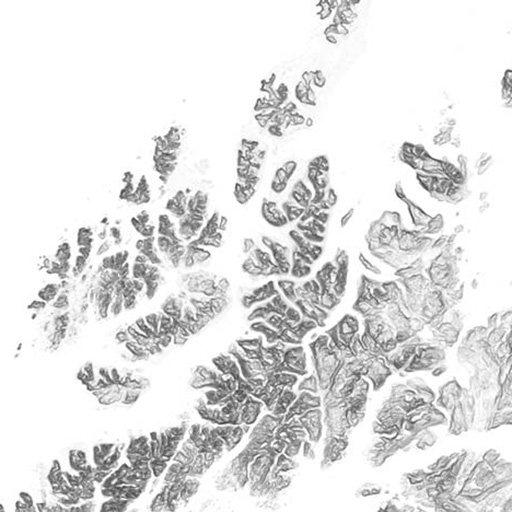
Norx – Norway in a box
The data was released as a huge GeoJSON dump for the vectors and USGS DEM-files for elevation maps. Going from raw data to a nice maps means enduring hours and days of wrangling. But we did all that so you don't have to. You just run "vagrant up" or download a ready-to-run VM.
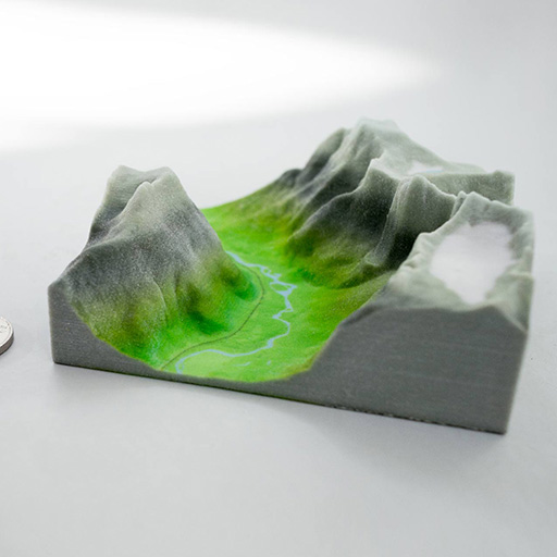
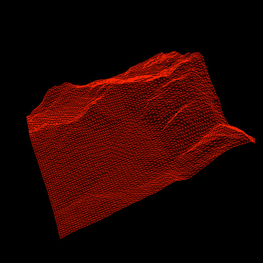
Terrafab
Ok, quite objectively – Norway has a spectacular natural landscape. People travel here from all over just to stumble around in it. What if you could choose any part of it and then have it home delivered as a full color 3d-print? Well, now you can.
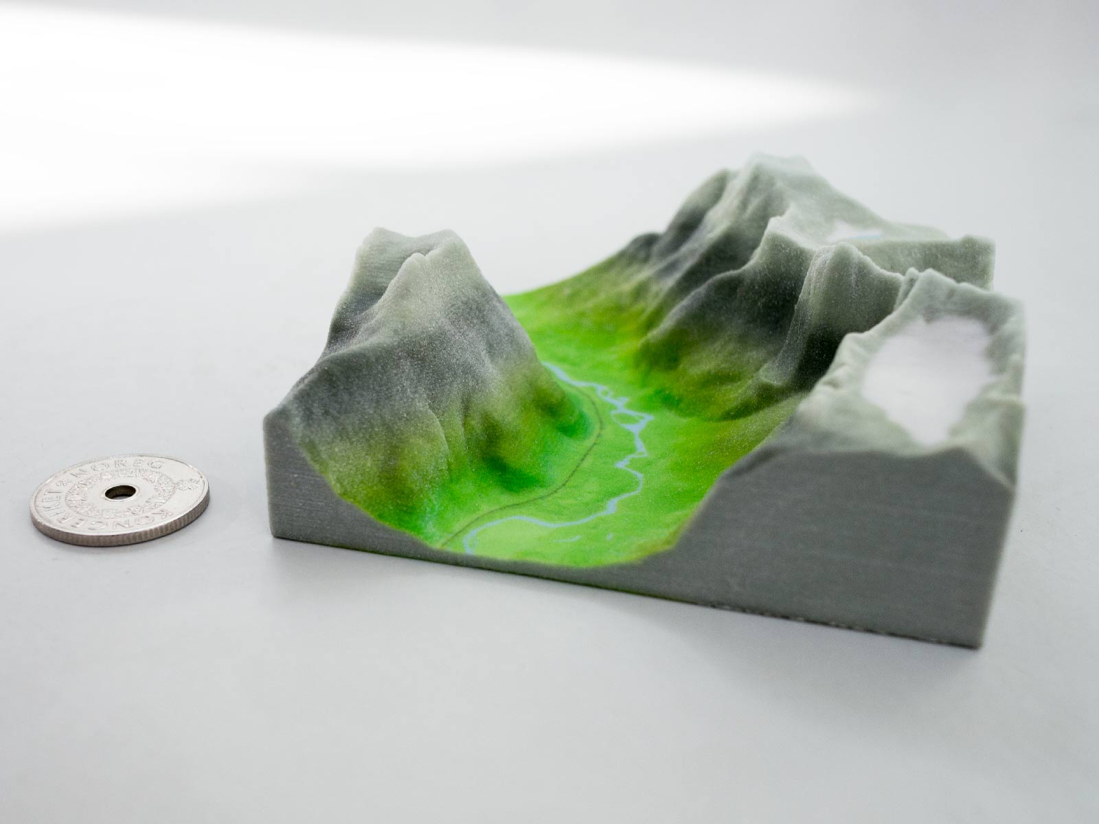
Try Terrafab Read our project notes
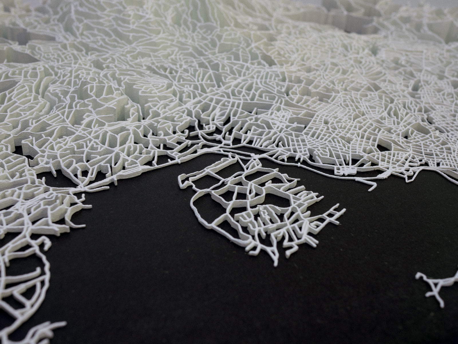
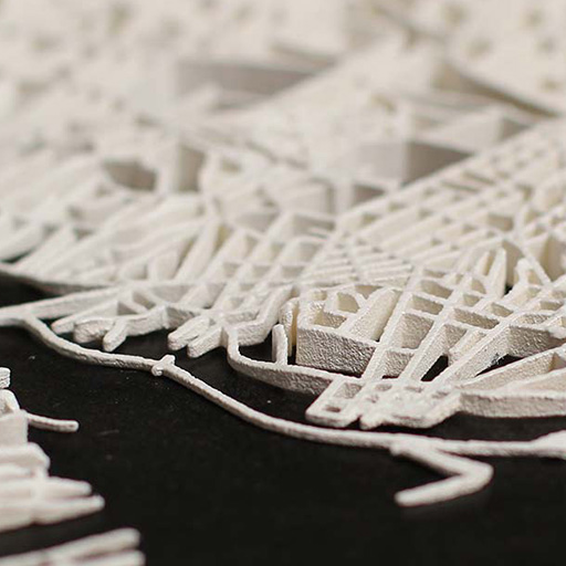
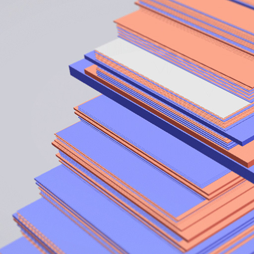
Intersections
To get to know the data properly we needed to use it for different purposes. We chose two data sets for an abstract and lateral exploration: the smallest administrative boundaries in Norway (grunnkretser) and the set of roads and footpaths. We combined these data sources with others, built 3d models and did 40 hour print runs on an SLS machine to print them out of nylon dust.
In Conclusion
We've had so much fun with these projects and earnestly hope they are both useful and inspirational to anyone interested in geospatial data in general and specifically the open data released by the Norwegian Mapping Authority.
Related projects
Other projects
-

PANDA
Supercolluder for the gig economy
-
Principal Components
Machine learning in search of the uncanny
-

OMA Website
Simple surface, intricate clockwork
-
Underskog
Friendly community for the Norwegian cultural fringe.
-
Mapfest!
Helping liberate Norwegian geodata
-
Chorderoy
Efficient text input for mobile and wearable devices
-

Bandwagon
Battle of the bands, local media edition
-
Repcol
Representativity in the collections of the Norwegian National Museum